Wind and precipitation
The most common wind direction in the mountains is southwesterly. The air is pushed up by the mountain chain and is cooled off in the higher air layers. The clouds that are formed then release precipitation in the form of rain or snow. The precipitation mainly ends up to the windward side, meaning the side of the mountain that the wind comes from.
This is why precipitation is normal on the western part of the mountains. The mountains generally have a little more precipitation than the rest of the country. But in the mountains, we also find the areas with the least precipitation in Sweden. The area at Abisko has the least annual precipitation in the country. There, the sun can shine from a blue sky when the rain pours down on the slope at the border just kilometres away.
Always have respect for the wind!
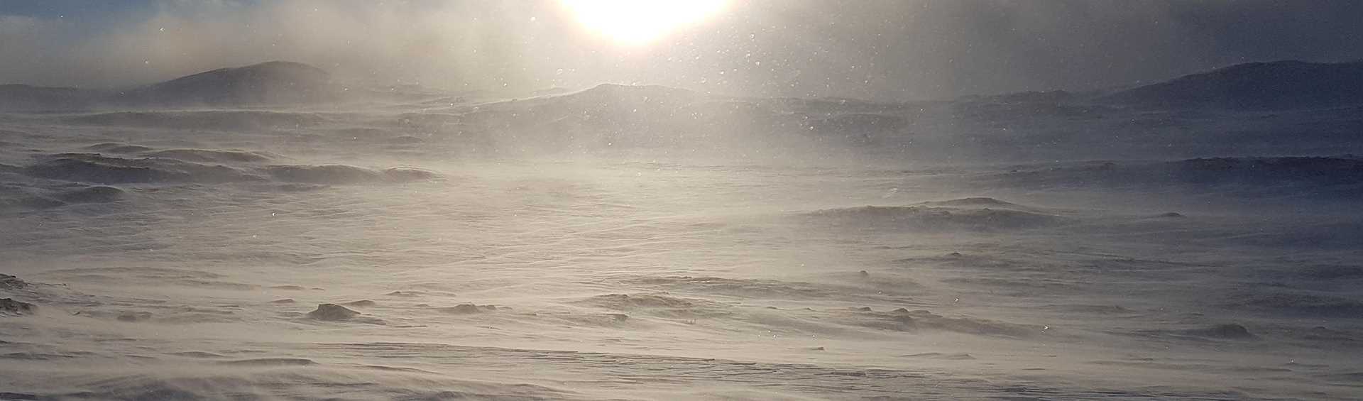
The wind is treacherous. It has a pleasant side that messes up the hair a little and cools and caresses on a hot summer day. But in the mountains in winter, combined with cold and snow, it can be deadly. “Moderate to fresh breeze” does not sound so dangerous. But at -10 degrees, the actual cold is then closer to -20 degrees!
If the wind picks up, it gets even colder and also whirls up snow so that it is hard to see. That is when it begins to get dangerous, when one gets tired, is freezing and has difficulty seeing the guide crosses.
Cold down and warm up
During the early and mid-winter, before the sun has begun to provide warmth, it is most often cold the entire day. In general, it is colder down in lowland terrain than up on the mountain. Cold heavy air “pours” down along the side of the mountain and stays in valleys and over marshes where the cold is amplified extra at night. Often it also becomes raw and foggy. The difference in temperature can be 30 degrees between the valley and the mountaintop.
Be observant of drops in air pressure!
When a deep low pressure system approaches from the west after a period of cold and beautiful winter weather, one should be on the look-out. The difference in air pressure means that the wind gains speed. Southerly winds in the lower mountain terrain can increase from weak to almost storm winds in a few hours. When the heavy cold air over the mountain above the tree line begins moving it falls with increasing speed down through mountain passes and ravines. It entails a hard ice cold wind that can reach storm strength.
These falling winds sometimes occur on the north side of Sylarna and the Anaris and Oviks Mountains, but also elsewhere, such as at Torneträsk. The cold air combined with hard snowdrifts and the wind’s cooling effect entail mortal danger.